Cape Wind: The Project
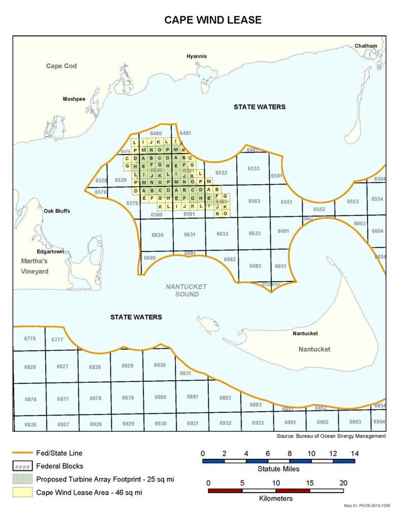
In December 2017, Cape Wind surrendered its lease, but we must remain vigilant to ensure long-term protection for the Sound so that it is never again threatened by industrial development. What follows in this section is a description of the now-defunct project and the risks it posed to our environment, economy, safety, historic landmarks, commercial fishing, and local tribes.
Impacts
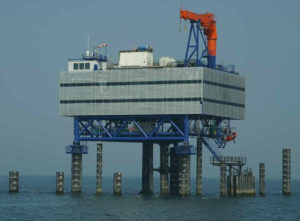
Cape Wind would have posed threats and risks to the rich environment of Nantucket Sound during both construction and operations. A loss of habitat, changes in tidal currents, and harm or mortality to threatened and endangered avian and marine species would have likely resulted. Further, Cape Wind’s electrical service platform, which would have held 30,000 gallons of transformer oil, would have introduced the chance of an oil spill. Cape Wind’s own studies show that in the event of a spill, oil would reach the shoreline of the Cape and Islands in less than five hours. The project would have also disrupted commercial and recreational fishing in the resource-rich shoal area where Cape Wind would be situated.
Cape Wind would have destroyed the tribal and historic values of Nantucket Sound. The local Wampanoag Tribes of Gayhead/Aquinnah and Mashpee believe Cape Wind would have not only desecrated sacred land, but also harmed their traditional religious and cultural practices. They are supported by the United Southern and Eastern Tribes, 25 federally-recognized Tribes. Wampanoag means “People of the First Light” and, as such, an unobstructed view of the sun rising over the Sound is integral to their way of life and traditions.
In addition, Cape Wind would have adversely impacted hundreds of historic properties dotting the Cape and Islands shorelines as well as several National Historic Landmarks, including the island of Nantucket. The federal Advisory Council on Historic Preservation recommended Cape Wind “be denied or relocated” because it would have a “permanent and devastating effect on the historic and cultural properties of the Sound.”
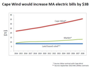
Based on its terminated contracts with National Grid and Eversource, Cape Wind would have added $3 billion in surcharges for Massachusetts ratepayers. Such rate increases would have led to job losses as businesses strove to offset these costs. These contracts have been canceled, due to Cape Wind’s failure to close on financing. Cape Wind would have also harmed the Cape and Islands economy by threatening tourism and commercial fishing and by lowering property values.
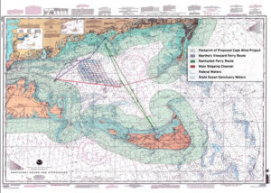
Navigational safety – Cape Wind would have threatened the safety of millions of travelers crossing the Sound. The 130 turbines would have jeopardized navigational safety by creating obstructions that ferries, cargo ships, and pleasure craft would have to negotiate not only in clear weather, but in dense fog and highly variable weather conditions characteristic of the Sound. The spinning turbine blades would have also interfered with marine radar.
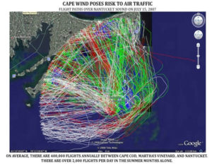
Aviation safety – Cape Wind would have also posed a significant risk to the 400,000 flights and millions of passengers that traverse Nantucket Sound every year due to radar interference and its location in the center of three airports. It would have also impacted search and rescue efforts.
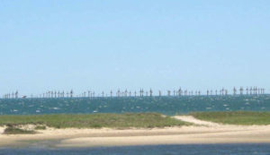
Cape Wind’s 130 wind turbines, each 440 feet tall, would have been highly visible from the south shore of Cape Cod from Falmouth to Chatham, the eastern shore of Martha’s Vineyard from Vineyard Haven to Edgartown and Cape Pogue, and the northern shore of Nantucket from Wauwinet to Madaket. With hundreds of fixed and flashing navigational and aviation lights, the turbines would have urbanized the night-time sky.
Alternative Sites
The Alliance participated in the establishment of rules and regulations governing offshore wind energy development. When Cape Wind was first proposed in 2001, there was no leasing authority, federal planning or competitive bidding for wind sites in federal waters. In 2005, the Energy Policy Act established federal leasing and called for regulations to govern renewable energy, which were completed in 2009. The Alliance promoted marine spatial planning and the creation of development zones to ensure appropriate development as well as exclusion zones to protect the marine environment. In 2010, the federal government’s “Smart from the Start” initiative led to the identification of specific areas to minimize conflicts, offshore lease sales and the progress of projects like Vineyard Wind in sites less conflicted than Nantucket Sound.
Offshore wind energy areas in MA and RI
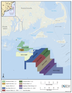 Based on a public process with stakeholder input, the federal government identified offshore Wind Energy Areas along the east coast that aim to minimize conflicts to be suitable for and expedite offshore wind development.
Four developers now hold leases offshore of Massachusetts and Rhode Island: Vineyard Wind, Mayflower Wind, Ørsted Wind (operating as South Fork Wind, Sunrise Wind, Baystate Wind and Revolution Wind), and Equinor Wind (which owns Beacon Wind).
Vineyard Wind is expected to be the first major operational offshore wind project. In May 2021, Vineyard Wind received final federal approval for its 800 megawatt (MW) offshore wind project. It will be located 12 nautical miles off the shore of Martha’s Vineyard and Nantucket with a lease term of 25 years.
There are several other regional projects that are currently under federal review. Revolution Wind is a 704 to 880 MW project off the coast of Rhode Island and Massachusetts. Sunrise Wind is proposed for the lease area south of Revolution Wind. Vineyard Wind South would be built just below the first approved Vineyard Wind project. South Fork Wind’s Construction and Operations Plan was released in May of 2021 and is awaiting final approval.


